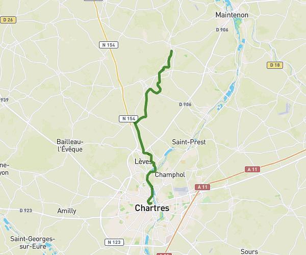
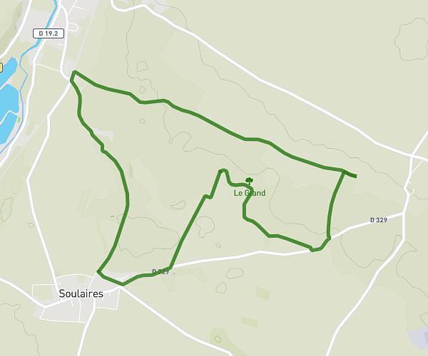
This hiking trail covers 5.564mi starting from Champhol, Eure-et-Loir. The hike does not return to the trailhead and ends near 11 Rue Charles Péguy, 28300 Coltainville, France. This hike is rated as easy, plan for about 2h29m to complete it. The route has an elevation gain of 308ft and an elevation loss of 279ft.
Champhol
Route details
2.24mph
Speed
1062 kcal
Calories burned
2.0%
Avg grade
Point to point
Route type
387ft
Min altitude
499ft
Max altitude
Route profile
308ft
Elevation gain
279ft
Elevation loss
387ft
Min altitude
499ft
Max altitude
How to get there
Trailhead: 58 Chemin De Fontaine Bouillant, 28300 Champhol, France
GPS coordinates of the trailhead: 48.47898, 1.50476 / 48°28'44'' N, 1°30'17'' E