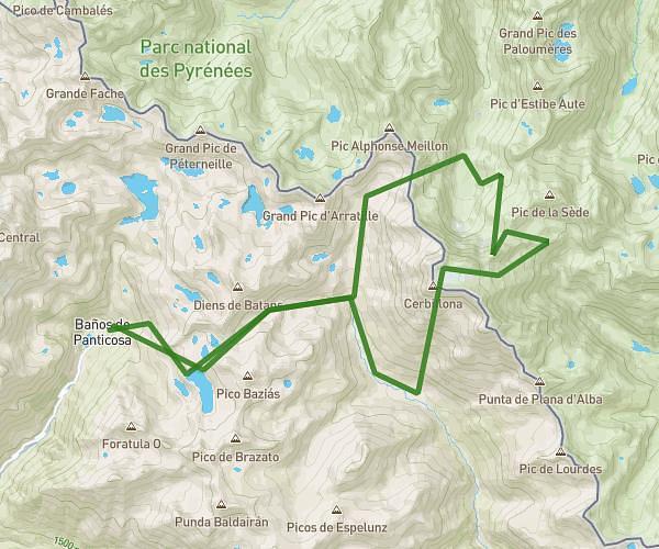
This running route covers 8.802mi starting from Panticosa, Huesca. The run is a loop trail and returns to the trailhead. This run is rated as hard, expect about 4h to complete it. The route has an elevation gain of 4452ft and an elevation loss of 4570ft.
Baños panti-cresterio Algas + Argualas + Garmo Negro - ibon arnales- baños panti
Route details
2.2mph
Speed
2744 kcal
Calories burned
Loop trail
Route type
5036ft
Min altitude
9606ft
Max altitude
High altitude
Route profile
4452ft
Elevation gain
4570ft
Elevation loss
5036ft
Min altitude
9606ft
Max altitude
How to get there
Trailhead: Calle Balneario, 22650 Panticosa, Huesca, Spain
GPS coordinates of the trailhead: 42.761653, -0.233528 / 42°45'41'' N, 0°14'0'' W