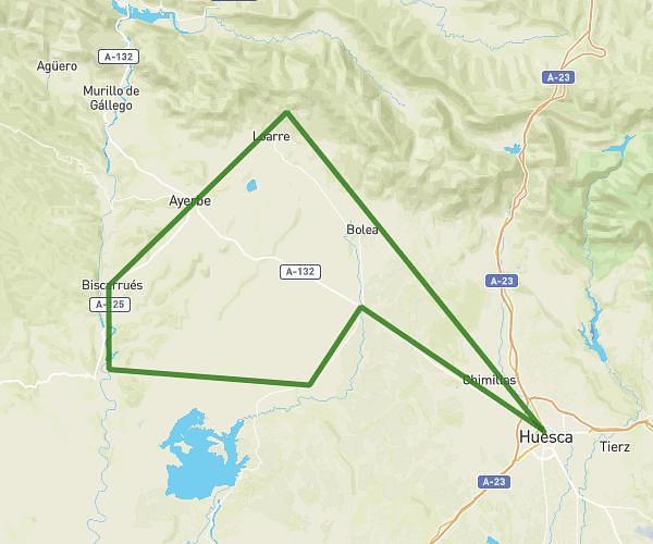
This cycling route covers 46.989mi starting from Loporzano, Huesca. The ride does not return to the trailhead and ends near Ds Afueras Ag Loporzano 34, 22192 Loporzano, Huesca, Spain. This route is rated as strenuous, plan for about 4h30m to complete it. The route has an elevation gain of 764ft and an elevation loss of 735ft.
Desde Huesca, circular hasta Bierge
Route details
2372 kcal
Calories burned
0.6%
Avg grade
Point to point
Route type
1555ft
Min altitude
2136ft
Max altitude
Route profile
764ft
Elevation gain
735ft
Elevation loss
1555ft
Min altitude
2136ft
Max altitude
How to get there
Trailhead: Carretera De Abiego, 22192 Loporzano, Huesca, Spain
GPS coordinates of the trailhead: 42.147746, -0.327308 / 42°8'51'' N, 0°19'38'' W