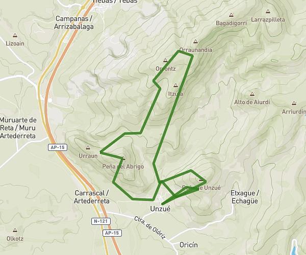
This running route covers 12.808mi starting from Unzué, Navarre. The run is a loop trail and returns to the trailhead. This run is rated as strenuous, expect about 4h to complete it. The route has an elevation gain of 3668ft and an elevation loss of 3645ft.
HML (peñita unzué + sierra alaitz)
Route details
3.2mph
Speed
2744 kcal
Calories burned
Loop trail
Route type
2126ft
Min altitude
3786ft
Max altitude
Route profile
3668ft
Elevation gain
3645ft
Elevation loss
2126ft
Min altitude
3786ft
Max altitude
How to get there
Trailhead: Calle La Peña 10, 31396 Unzué, Navarre, Spain
GPS coordinates of the trailhead: 42.652999, -1.624883 / 42°39'10'' N, 1°37'29'' W