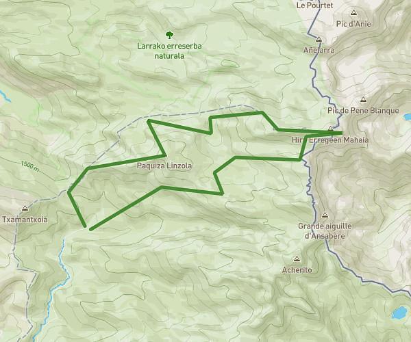
This running route covers 14.648mi starting from Ansó, Huesca. The run is a loop trail and returns to the trailhead. This run is rated as strenuous, expect about 5h to complete it. The route has an elevation gain of 7461ft and an elevation loss of 7457ft.
Txamantxoia + Sobarcal + Acherito + Petretxema
Route details
2.93mph
Speed
3430 kcal
Calories burned
Loop trail
Route type
4341ft
Min altitude
7680ft
Max altitude
Route profile
7461ft
Elevation gain
7457ft
Elevation loss
4341ft
Min altitude
7680ft
Max altitude
How to get there
Trailhead: Carretera De Zuriza A Linza 2, 22728 Ansó, Huesca, Spain
GPS coordinates of the trailhead: 42.897887, -0.799342 / 42°53'52'' N, 0°47'57'' W