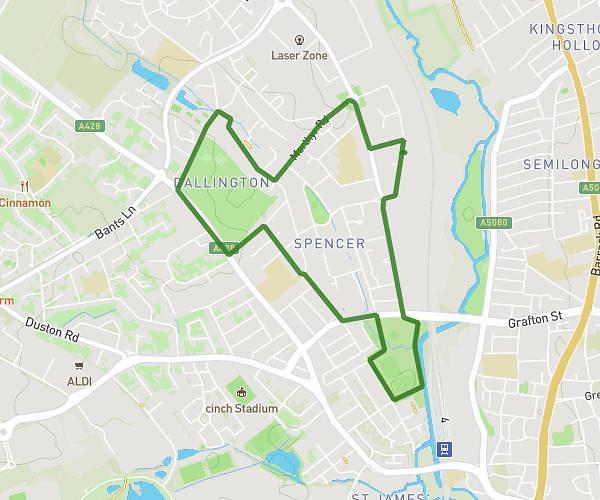
This walking route covers 1.096mi starting from Northampton, England. The walk is a loop trail and returns to the trailhead. This walk is rated as easy, plan for about 45m14s to complete it. The route has an elevation gain of 66ft and an elevation loss of 66ft.
First walk
Route details
41:16/mi
Pace
185 kcal
Calories burned
Loop trail
Route type
226ft
Min altitude
266ft
Max altitude
Route profile
66ft
Elevation gain
66ft
Elevation loss
226ft
Min altitude
266ft
Max altitude
How to get there
Trailhead: Streatfield Road, NN5 7DE Northampton
GPS coordinates of the trailhead: 52.24997, -0.91241 / 52°14'59'' N, 0°54'44'' W