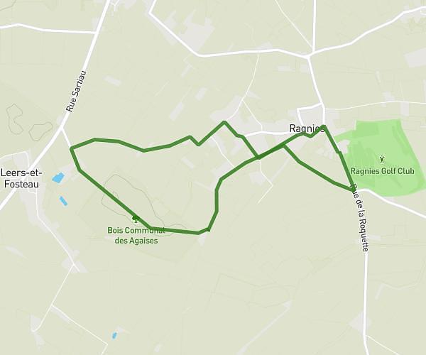
This hiking trail covers 4.781mi starting from Mons, Hainaut. The hike is a loop trail and returns to the trailhead. This hike is rated as easy, plan for about 51m17s to complete it. The route has an elevation gain of 282ft and an elevation loss of 282ft.
Découverte Hyon
Route details
5.59mph
Speed
366 kcal
Calories burned
2.2%
Avg grade
Loop trail
Route type
95ft
Min altitude
144ft
Max altitude
Route profile
282ft
Elevation gain
282ft
Elevation loss
95ft
Min altitude
144ft
Max altitude
How to get there
Trailhead: Rue André Masquelier 4, 7000 Mons, Hainaut, Belgium
GPS coordinates of the trailhead: 50.451705, 3.944243 / 50°27'6'' N, 3°56'39'' E