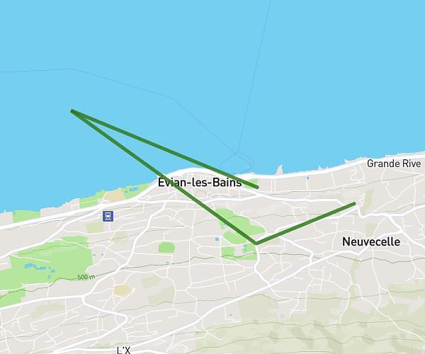
This walking route covers 3.126mi starting from Neuvecelle, Haute-Savoie. The walk does not return to the trailhead and ends near 7 Avenue D'abondance, 74500 Évian-les-Bains, France. This walk is rated as moderate, plan for about 1h8m to complete it. The route has an elevation gain of 381ft and an elevation loss of 505ft.
1er sport
Route details
21:45/mi
Pace
278 kcal
Calories burned
Point to point
Route type
1280ft
Min altitude
1621ft
Max altitude
Route profile
381ft
Elevation gain
505ft
Elevation loss
1280ft
Min altitude
1621ft
Max altitude
How to get there
Trailhead: 1267 Avenue D'abondance, 74500 Neuvecelle, France
GPS coordinates of the trailhead: 46.398851, 6.610036 / 46°23'55'' N, 6°36'36'' E