MapPlanner
5.269mi
Distance
41m57s
Duration
7:58/mi
Pace
Moderate
Level

entrainement

Route details

7.54mph
Speed
480 kcal
Calories burned
Loop trail
Route type
436ft
Min altitude
643ft
Max altitude

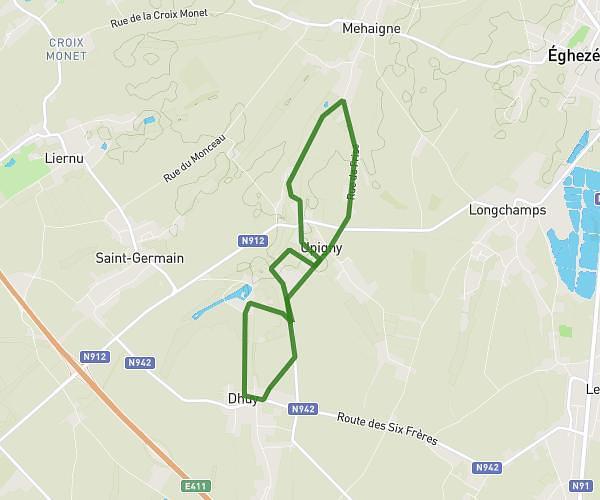
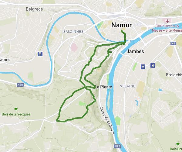
This running route covers 5.269mi starting from Namur, Namur. The run is a loop trail and returns to the trailhead. This run is rated as moderate, expect about 41m57s to complete it. The route has an elevation gain of 210ft and an elevation loss of 138ft.

Route profile

210ft
Elevation gain
138ft
Elevation loss
436ft
Min altitude
643ft
Max altitude

How to get there

Trailhead: Rue De L'yser, 5020 Namur

GPS coordinates of the trailhead: 50.49119, 4.88782 / 50°29'28'' N, 4°53'16'' E

Caution: May Cross Private Property

This route may pass through or near private property. Always respect posted signs, obtain permission where required, and follow local trespassing laws. MapPlanner does not guarantee public access along any route.

Safety Notice

Trail and road conditions may change without notice due to weather, construction, or other factors. Always verify current conditions before heading out. You are responsible for your own safety — follow local signage, obey traffic laws, and use your best judgment on the trail.