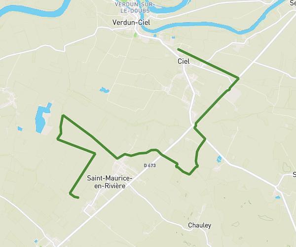
This hiking trail covers 3.218mi starting from Simandre, Saône-et-Loire. The hike is a loop trail and returns to the trailhead. This hike is rated as easy, plan for about 1h8m to complete it. The route has an elevation gain of 210ft and an elevation loss of 207ft.
Randonnée du vin chaud 16/11/25
Route details
2.84mph
Speed
486 kcal
Calories burned
2.5%
Avg grade
Loop trail
Route type
636ft
Min altitude
692ft
Max altitude
Route profile
210ft
Elevation gain
207ft
Elevation loss
636ft
Min altitude
692ft
Max altitude
How to get there
Trailhead: 140 Chemin Du Lavoir, 71290 Simandre, France
GPS coordinates of the trailhead: 46.614296, 5.019057 / 46°36'51'' N, 5°1'8'' E