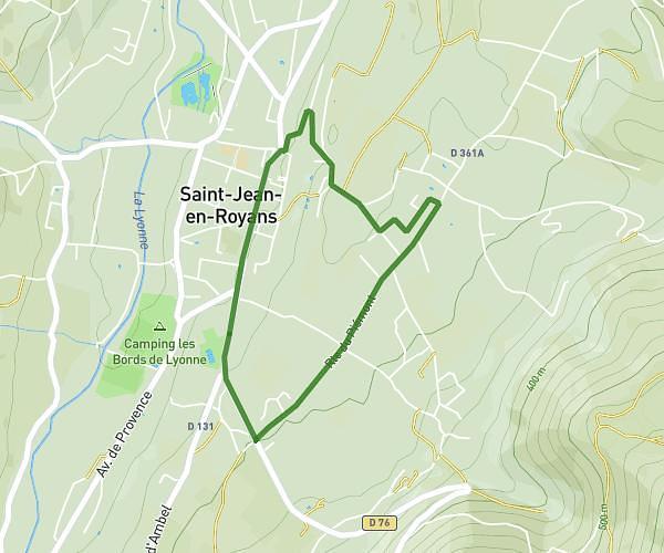
This running route covers 5.384mi starting from Chatuzange-le-Goubet, Drôme. The run is a loop trail and returns to the trailhead. This run is rated as moderate, expect about 58m to complete it. The route has an elevation gain of 440ft and an elevation loss of 440ft.
8_de_chatu
Route details
5.57mph
Speed
663 kcal
Calories burned
Loop trail
Route type
696ft
Min altitude
915ft
Max altitude
Route profile
440ft
Elevation gain
440ft
Elevation loss
696ft
Min altitude
915ft
Max altitude
How to get there
Trailhead: 8 Place Du 19 Mars 1962, 26300 Chatuzange-le-Goubet, France
GPS coordinates of the trailhead: 45.007012, 5.091065 / 45°0'25'' N, 5°5'27'' E