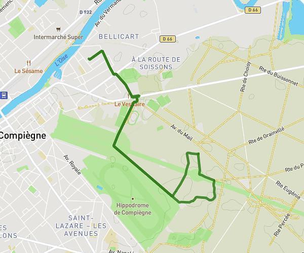
This running route covers 6.344mi starting from Compiègne, Oise. The run is a loop trail and returns to the trailhead. This run is rated as moderate, expect about 1h1m to complete it. The route has an elevation gain of 295ft and an elevation loss of 292ft.
Course 10km Chanel
Route details
6.21mph
Speed
700 kcal
Calories burned
Loop trail
Route type
92ft
Min altitude
125ft
Max altitude
Route profile
295ft
Elevation gain
292ft
Elevation loss
92ft
Min altitude
125ft
Max altitude
How to get there
Trailhead: 7 Rue Ferdinand De Lesseps, 60200 Compiègne, France
GPS coordinates of the trailhead: 49.38971, 2.78194 / 49°23'22'' N, 2°46'54'' E