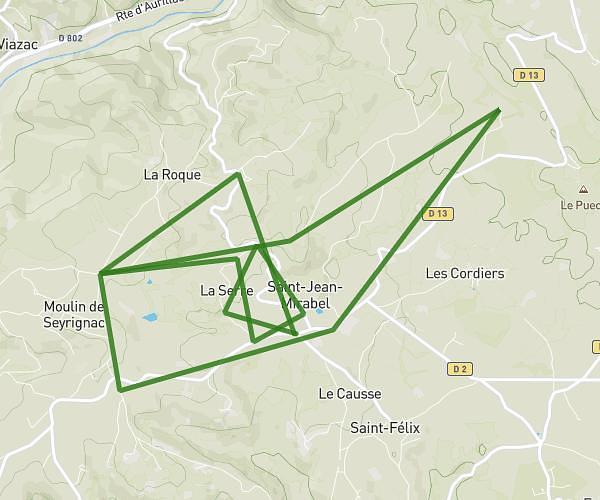
This running route covers 6.296mi starting from Flagnac, Aveyron. The run is a loop trail and returns to the trailhead. This run is rated as easy, expect about 1h5m to complete it. The route has an elevation gain of 102ft and an elevation loss of 108ft.
Base hebdomadaire - Flagnac
Route details
5.81mph
Speed
743 kcal
Calories burned
Loop trail
Route type
666ft
Min altitude
771ft
Max altitude
Route profile
102ft
Elevation gain
108ft
Elevation loss
666ft
Min altitude
771ft
Max altitude
How to get there
Trailhead: Impasse Du Peyrou, 12300 Flagnac, France
GPS coordinates of the trailhead: 44.607632, 2.248385 / 44°36'27'' N, 2°14'54'' E