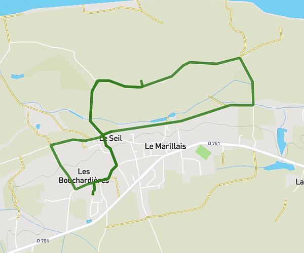
This running route covers 13.0mi starting from Saint-Julien-de-Concelles, Loire-Atlantique. The run is a loop trail and returns to the trailhead. This run is rated as strenuous, expect about 2h19m to complete it. The route has an elevation gain of 16ft and an elevation loss of 36ft.
21km anglesort
Route details
5.61mph
Speed
1590 kcal
Calories burned
Loop trail
Route type
16ft
Min altitude
46ft
Max altitude
Route profile
16ft
Elevation gain
36ft
Elevation loss
16ft
Min altitude
46ft
Max altitude
How to get there
Trailhead: 6 Rue De La Graholière, 44450 Saint-Julien-de-Concelles, France
GPS coordinates of the trailhead: 47.2495, -1.39166 / 47°14'58'' N, 1°23'29'' W