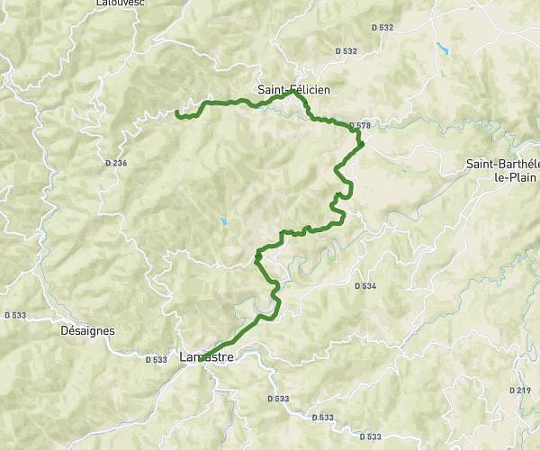
This cycling route covers 12.608mi starting from Lamastre, Ardèche. The ride does not return to the trailhead and ends near 20 Impasse Du Petit Meillat, 07410 Pailharès, France. This route is rated as hard, plan for about 1h16m to complete it. The route has an elevation gain of 1939ft and an elevation loss of 873ft.
lamastre Pailharès via Nozières
Route details
691 kcal
Calories burned
4.2%
Avg grade
Point to point
Route type
1188ft
Min altitude
3123ft
Max altitude
Route profile
1939ft
Elevation gain
873ft
Elevation loss
1188ft
Min altitude
3123ft
Max altitude
How to get there
Trailhead: 4 Place Des Frères Montgolfier, 07270 Lamastre, France
GPS coordinates of the trailhead: 44.98545, 4.57967 / 44°59'7'' N, 4°34'46'' E