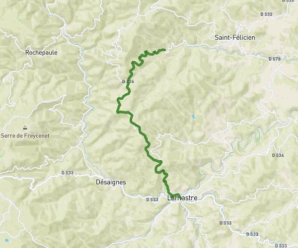
This cycling route covers 17.941mi starting from Pailharès, Ardèche. The ride does not return to the trailhead and ends near Rue Ferdinand Hérold, 07270 Lamastre. This route is rated as moderate, plan for about 1h48m to complete it. The route has an elevation gain of 341ft and an elevation loss of 1178ft.
Pailharès Lamastre via Bozas
Route details
950 kcal
Calories burned
1.6%
Avg grade
Point to point
Route type
1240ft
Min altitude
2077ft
Max altitude
Route profile
341ft
Elevation gain
1178ft
Elevation loss
1240ft
Min altitude
2077ft
Max altitude
How to get there
Trailhead: Route De Saint-Félicien, 07410 Pailharès
GPS coordinates of the trailhead: 45.07832, 4.56525 / 45°4'41'' N, 4°33'54'' E