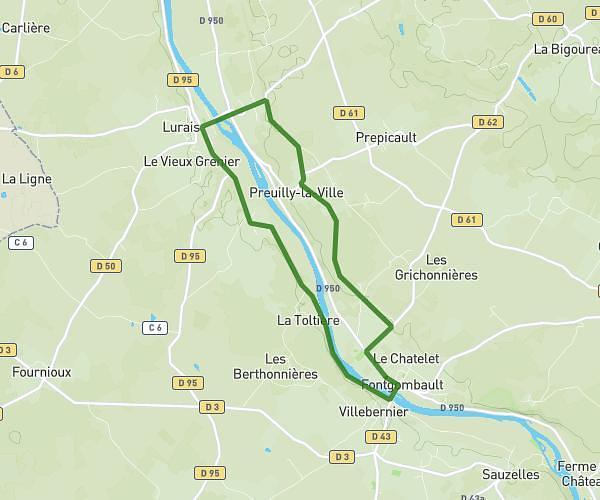
This running route covers 3.88mi starting from Fontgombault, Indre. The run is a loop trail and returns to the trailhead. This run is rated as easy, expect about 37m12s to complete it. The route has an elevation gain of 564ft and an elevation loss of 564ft.
Traill 2 tours
Route details
6.26mph
Speed
425 kcal
Calories burned
Loop trail
Route type
233ft
Min altitude
407ft
Max altitude
Route profile
564ft
Elevation gain
564ft
Elevation loss
233ft
Min altitude
407ft
Max altitude
How to get there
Trailhead: 35 Rue De L'abbaye, 36220 Fontgombault, France
GPS coordinates of the trailhead: 46.67503, 0.98365 / 46°40'30'' N, 0°59'1'' E