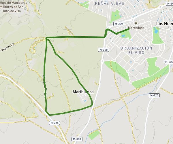
This running route covers 0.501mi starting from Campo Real, Madrid. The run is a loop trail and returns to the trailhead. This run is rated as easy, expect about 2m40s to complete it. The route has an elevation gain of 59ft and an elevation loss of 49ft.
Oposición
Route details
11.28mph
Speed
30 kcal
Calories burned
Loop trail
Route type
2408ft
Min altitude
2438ft
Max altitude
Route profile
59ft
Elevation gain
49ft
Elevation loss
2408ft
Min altitude
2438ft
Max altitude
How to get there
Trailhead: Calle Rosalía De Castro 26, 28510 Campo Real, Madrid, Spain
GPS coordinates of the trailhead: 40.34296, -3.37856 / 40°20'34'' N, 3°22'42'' W