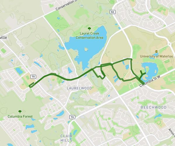
This cycling route covers 7.512mi starting from Waterloo, Ontario. The ride is a loop trail and returns to the trailhead. This route is rated as hard, plan for about 1h to complete it. The route has an elevation gain of 92ft and an elevation loss of 95ft.
16/05/25
Route details
527 kcal
Calories burned
0.5%
Avg grade
Loop trail
Route type
1112ft
Min altitude
1155ft
Max altitude
Route profile
92ft
Elevation gain
95ft
Elevation loss
1112ft
Min altitude
1155ft
Max altitude
How to get there
Trailhead: Erbsville Road, N2V 2S6 Waterloo
GPS coordinates of the trailhead: 43.47032, -80.59211 / 43°28'13'' N, 80°35'31'' W