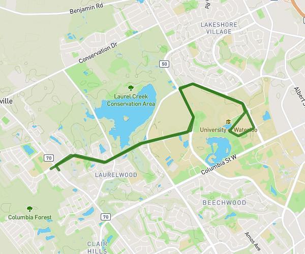
This cycling route covers 5.838mi starting from Waterloo, Ontario. The ride is a loop trail and returns to the trailhead. This route is rated as easy, plan for about 35m to complete it. The route has an elevation gain of 138ft and an elevation loss of 59ft.
30/05/25
Route details
308 kcal
Calories burned
0.6%
Avg grade
Loop trail
Route type
1109ft
Min altitude
1237ft
Max altitude
Route profile
138ft
Elevation gain
59ft
Elevation loss
1109ft
Min altitude
1237ft
Max altitude
How to get there
Trailhead: Laurelwood Drive, N2V 2W9 Waterloo
GPS coordinates of the trailhead: 43.47069, -80.59363 / 43°28'14'' N, 80°35'37'' W