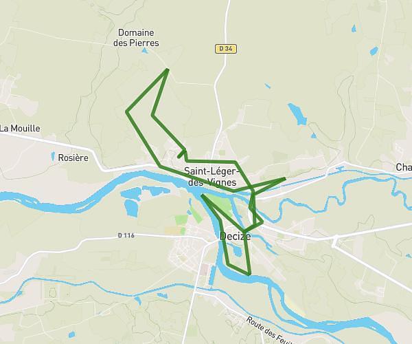
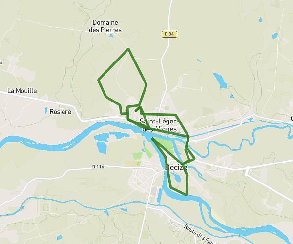
This running route covers 6.454mi starting from Varennes-Vauzelles, Nièvre. The run is a loop trail and returns to the trailhead. This run is rated as moderate, expect about 48m to complete it. The route has an elevation gain of 331ft and an elevation loss of 331ft.
VAUZELLES-COULANGES-10
Route details
8.07mph
Speed
549 kcal
Calories burned
Loop trail
Route type
587ft
Min altitude
758ft
Max altitude
Route profile
331ft
Elevation gain
331ft
Elevation loss
587ft
Min altitude
758ft
Max altitude
How to get there
Trailhead: Rue Ambroise Paré, 58640 Varennes-Vauzelles
GPS coordinates of the trailhead: 47.01868, 3.16267 / 47°1'7'' N, 3°9'45'' E