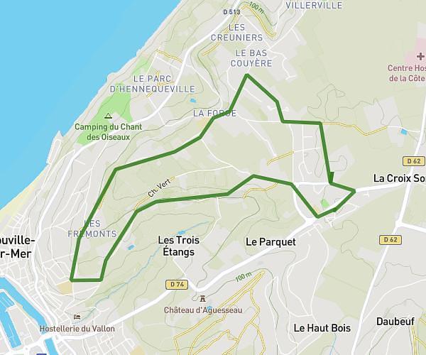
This running route covers 3.454mi starting from La Rivière-Saint-Sauveur, Calvados. The run is a loop trail and returns to the trailhead. This run is rated as easy, expect about 47m38s to complete it. The route has an elevation gain of 112ft and an elevation loss of 364ft.
LRSS
Route details
4.35mph
Speed
545 kcal
Calories burned
Loop trail
Route type
13ft
Min altitude
377ft
Max altitude
Route profile
112ft
Elevation gain
364ft
Elevation loss
13ft
Min altitude
377ft
Max altitude
How to get there
Trailhead: 211 Impasse Cayère, 14600 La Rivière-Saint-Sauveur, France
GPS coordinates of the trailhead: 49.405923, 0.253989 / 49°24'21'' N, 0°15'14'' E