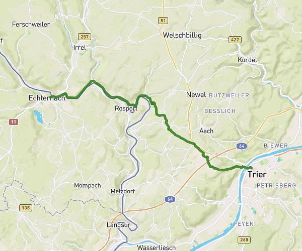
This cycling route covers 16.386mi starting from Mertert, Grevenmacher. The ride does not return to the trailhead and ends near Rue Du Pont, 6471 Echternach. This route is rated as moderate, plan for about 1h45m to complete it. The route has an elevation gain of 561ft and an elevation loss of 512ft.
Ragondins 2023
Route details
931 kcal
Calories burned
1.2%
Avg grade
Point to point
Route type
446ft
Min altitude
915ft
Max altitude
Route profile
561ft
Elevation gain
512ft
Elevation loss
446ft
Min altitude
915ft
Max altitude
How to get there
Trailhead: Place De La Gare, 6674 Mertert
GPS coordinates of the trailhead: 49.70328, 6.4781 / 49°42'11'' N, 6°28'41'' E