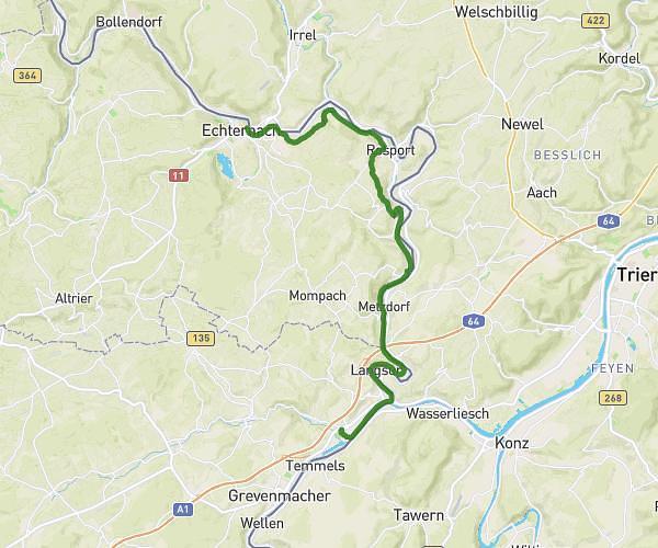
This cycling route covers 14.142mi starting from Echternach, Echternach. The ride does not return to the trailhead and ends near Remigiusstraße, 54292 Trier. This route is rated as strenuous, plan for about 1h31m to complete it. The route has an elevation gain of 1752ft and an elevation loss of 1850ft.
Ragondins 2023/2
Route details
821 kcal
Calories burned
4.8%
Avg grade
Point to point
Route type
417ft
Min altitude
1296ft
Max altitude
Route profile
1752ft
Elevation gain
1850ft
Elevation loss
417ft
Min altitude
1296ft
Max altitude
How to get there
Trailhead: Rue Du Pont, 6484 Echternach
GPS coordinates of the trailhead: 49.81252, 6.4252 / 49°48'45'' N, 6°25'30'' E