MapPlanner
26.447mi
Distance
2h40m
Duration
9.92mph
Speed
+2733ft
Elevation gain
-2746ft
Elevation loss
Strenuous
Level

Emmanuel

Route details

1437 kcal
Calories burned
3.9%
Avg grade
Loop trail
Route type
33ft
Min altitude
1506ft
Max altitude

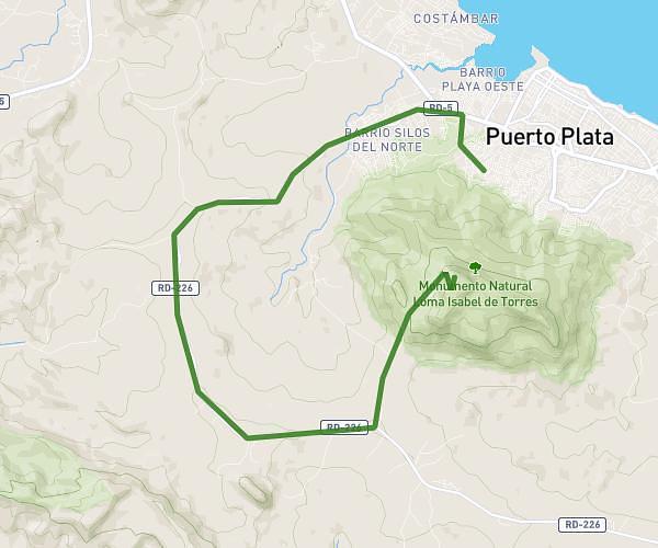
This cycling route covers 26.447mi starting from Puerto Plata, Puerto Plata. The ride is a loop trail and returns to the trailhead. This route is rated as strenuous, plan for about 2h40m to complete it. The route has an elevation gain of 2733ft and an elevation loss of 2746ft.

Route profile

2733ft
Elevation gain
2746ft
Elevation loss
33ft
Min altitude
1506ft
Max altitude

How to get there

Trailhead: Calle 43ª, Puerto Plata, Puerto Plata, Dominican Republic

GPS coordinates of the trailhead: 19.783316, -70.704995 / 19°46'59'' N, 70°42'17'' W

Caution: May Cross Private Property

This route may pass through or near private property. Always respect posted signs, obtain permission where required, and follow local trespassing laws. MapPlanner does not guarantee public access along any route.

Safety Notice

Trail and road conditions may change without notice due to weather, construction, or other factors. Always verify current conditions before heading out. You are responsible for your own safety — follow local signage, obey traffic laws, and use your best judgment on the trail.