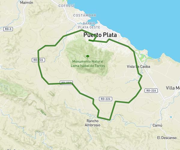
This cycling route covers 12.215mi starting from Puerto Plata, Puerto Plata. The ride does not return to the trailhead and ends near Camino Isabel De Torres, Puerto Plata, Puerto Plata, Dominican Republic. This route is rated as strenuous, plan for about 1h14m to complete it. The route has an elevation gain of 3182ft and an elevation loss of 771ft.
Loma isabela de torrez
Route details
690 kcal
Calories burned
6.1%
Avg grade
Point to point
Route type
62ft
Min altitude
2585ft
Max altitude
Steep climb
Route profile
3182ft
Elevation gain
771ft
Elevation loss
62ft
Min altitude
2585ft
Max altitude
How to get there
Trailhead: Calle 43ª, Puerto Plata, Puerto Plata, Dominican Republic
GPS coordinates of the trailhead: 19.783194, -70.704907 / 19°46'59'' N, 70°42'17'' W