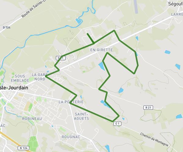
Explore this hiking route of 4,14mi starting from L'Isle-Jourdain, Gers. The hike does not return to the starting point and ends near Route De Ségoufielle, 32600 L'Isle-Jourdain. This hike has no defined difficulty level, plan for about 41m to complete it. The route has a positive elevation gain of 184ft and a negative elevation loss of 184ft.
calendrier 1
Route details
Route profile
184ft
Elevation +
184ft
Elevation -
466ft
Min altitude
502ft
Max altitude
How to get there
Route starting point: Rue De La Bascoulette, 32600 L'Isle-Jourdain
GPS coordinates of the starting point: 43.6151, 1.08186 / 43°36'54'' N, 1°4'54'' E