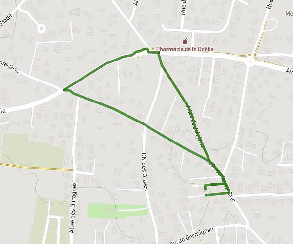
This hiking trail covers 5.555mi starting from Canéjan, Gironde. The hike is a loop trail and returns to the trailhead. This hike is rated as moderate, plan for about 1h30m to complete it. The route has an elevation gain of 436ft and an elevation loss of 433ft.
9km
Route details
3.7mph
Speed
646 kcal
Calories burned
3.0%
Avg grade
Loop trail
Route type
105ft
Min altitude
177ft
Max altitude
Route profile
436ft
Elevation gain
433ft
Elevation loss
105ft
Min altitude
177ft
Max altitude
How to get there
Trailhead: 10 Chemin Du Cassiot, 33610 Canéjan, France
GPS coordinates of the trailhead: 44.761433, -0.655769 / 44°45'41'' N, 0°39'20'' W