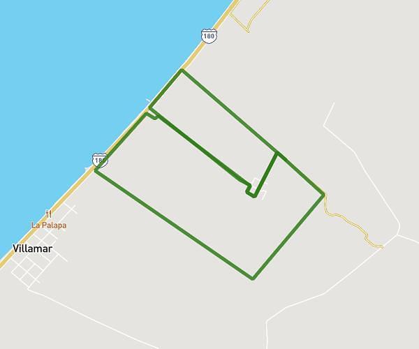
This running route covers 3.923mi starting from Champotón, Campeche. The run is a loop trail and returns to the trailhead. This run is rated as easy, expect about 42m to complete it. The route has an elevation gain of 52ft and an elevation loss of 56ft.
6KMCENCAEIM2025
Route details
5.6mph
Speed
480 kcal
Calories burned
Loop trail
Route type
0ft
Min altitude
43ft
Max altitude
Route profile
52ft
Elevation gain
56ft
Elevation loss
0ft
Min altitude
43ft
Max altitude
How to get there
Trailhead: Champotón, Campeche, 24410, Mexico
GPS coordinates of the trailhead: 19.295441, -90.751894 / 19°17'43'' N, 90°45'6'' W