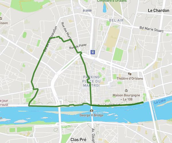
This running route covers 5.817mi starting from Orléans, Loiret. The run does not return to the trailhead and ends near Allée Des Mésanges, 45000 Orléans. This run is rated as moderate, expect about 1h15m to complete it. The route has an elevation gain of 249ft and an elevation loss of 246ft.
10km
Route details
4.65mph
Speed
858 kcal
Calories burned
Point to point
Route type
299ft
Min altitude
390ft
Max altitude
Route profile
249ft
Elevation gain
246ft
Elevation loss
299ft
Min altitude
390ft
Max altitude
How to get there
Trailhead: Venelle Des Églantiers, 45000 Orléans
GPS coordinates of the trailhead: 47.92262, 1.8897 / 47°55'21'' N, 1°53'22'' E