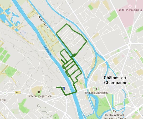
This hiking trail covers 3.24mi starting from Châlons-en-Champagne, Marne. The hike does not return to the trailhead and ends near Avenue Du 29 Août 1944, 51000 Châlons-en-Champagne. This hike is rated as easy, plan for about 1h2m to complete it. The route has an elevation gain of 118ft and an elevation loss of 121ft.
Rando main colorée
Route details
3.11mph
Speed
443 kcal
Calories burned
1.4%
Avg grade
Point to point
Route type
259ft
Min altitude
285ft
Max altitude
Route profile
118ft
Elevation gain
121ft
Elevation loss
259ft
Min altitude
285ft
Max altitude
How to get there
Trailhead: Rue René Lemoine, 51000 Châlons-en-Champagne
GPS coordinates of the trailhead: 48.94951, 4.37315 / 48°56'58'' N, 4°22'23'' E