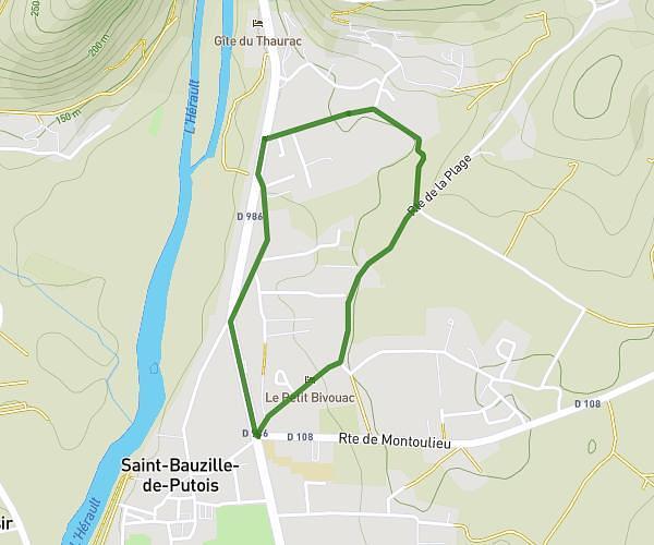
This running route covers 1.594mi starting from Saint-Martin-de-Londres, Hérault. The run does not return to the trailhead and ends near Impasse De La Rasimière, 34380 Saint-Martin-de-Londres, France. This run is rated as easy, expect about 15m to complete it. The route has an elevation gain of 56ft and an elevation loss of 33ft.
St Martin de Londres
Route details
6.38mph
Speed
172 kcal
Calories burned
Point to point
Route type
646ft
Min altitude
689ft
Max altitude
Route profile
56ft
Elevation gain
33ft
Elevation loss
646ft
Min altitude
689ft
Max altitude
How to get there
Trailhead: 289 Rue Des Aubépines, 34380 Saint-Martin-de-Londres, France
GPS coordinates of the trailhead: 43.7872, 3.73074 / 43°47'13'' N, 3°43'50'' E