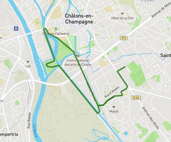
This hiking trail covers 7.453mi starting from Châlons-en-Champagne, Marne. The hike is a loop trail and returns to the trailhead. This hike is rated as easy, plan for about 2h30m to complete it. The route has an elevation gain of 39ft and an elevation loss of 39ft.
1ER parcours
Route details
2.98mph
Speed
1052 kcal
Calories burned
0.2%
Avg grade
Loop trail
Route type
246ft
Min altitude
269ft
Max altitude
Route profile
39ft
Elevation gain
39ft
Elevation loss
246ft
Min altitude
269ft
Max altitude
How to get there
Trailhead: Allée Des Tilleuls, 51000 Châlons-en-Champagne
GPS coordinates of the trailhead: 48.94716, 4.36341 / 48°56'49'' N, 4°21'48'' E