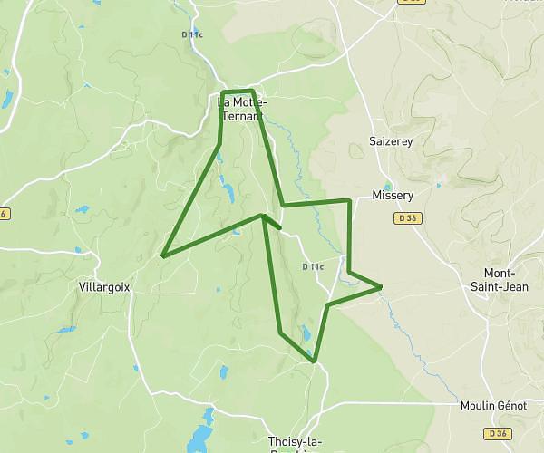
This running route covers 6.742mi starting from Thoisy-la-Berchère, Côte-d’Or. The run is a loop trail and returns to the trailhead. This run is rated as moderate, expect about 1h12m to complete it. The route has an elevation gain of 558ft and an elevation loss of 561ft.
Varennes
Route details
5.62mph
Speed
823 kcal
Calories burned
Loop trail
Route type
1224ft
Min altitude
1483ft
Max altitude
Route profile
558ft
Elevation gain
561ft
Elevation loss
1224ft
Min altitude
1483ft
Max altitude
How to get there
Trailhead: 2 Chemin De La Tuilerie, 21210 Thoisy-la-Berchère, France
GPS coordinates of the trailhead: 47.26087, 4.36076 / 47°15'39'' N, 4°21'38'' E