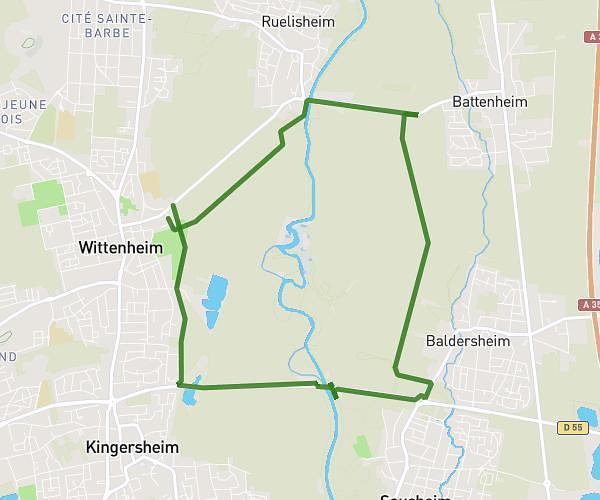
This running route covers 2.312mi starting from Rustenhart, Haut-Rhin. The run is a loop trail and returns to the trailhead. This run is rated as easy, expect about 25m to complete it. The route has an elevation gain of 3ft and an elevation loss of 0ft.
2e niveau
Route details
5.55mph
Speed
286 kcal
Calories burned
Loop trail
Route type
659ft
Min altitude
663ft
Max altitude
Route profile
3ft
Elevation gain
0ft
Elevation loss
659ft
Min altitude
663ft
Max altitude
How to get there
Trailhead: 5 Impasse Des Églantines, 68740 Rustenhart, France
GPS coordinates of the trailhead: 47.94336, 7.45642 / 47°56'36'' N, 7°27'23'' E