MapPlanner
17.258mi
Distance
1h44m
Duration
9.95mph
Speed
+958ft
Elevation gain
-958ft
Elevation loss
Hard
Level

Touraine velo

Route details

923 kcal
Calories burned
2.1%
Avg grade
Loop trail
Route type
177ft
Min altitude
381ft
Max altitude

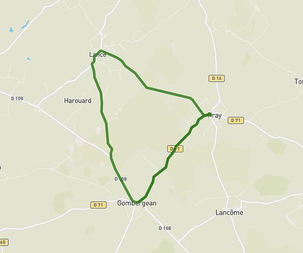
This cycling route covers 17.258mi starting from Nazelles-Négron, Indre-et-Loire. The ride is a loop trail and returns to the trailhead. This route is rated as hard, plan for about 1h44m to complete it. The route has an elevation gain of 958ft and an elevation loss of 958ft.

Route profile

958ft
Elevation gain
958ft
Elevation loss
177ft
Min altitude
381ft
Max altitude

How to get there

Trailhead: 41 Rue Louis Viset, 37530 Nazelles-Négron, France

GPS coordinates of the trailhead: 47.43089, 0.94923 / 47°25'51'' N, 0°56'57'' E

Caution: May Cross Private Property

This route may pass through or near private property. Always respect posted signs, obtain permission where required, and follow local trespassing laws. MapPlanner does not guarantee public access along any route.

Safety Notice

Trail and road conditions may change without notice due to weather, construction, or other factors. Always verify current conditions before heading out. You are responsible for your own safety — follow local signage, obey traffic laws, and use your best judgment on the trail.