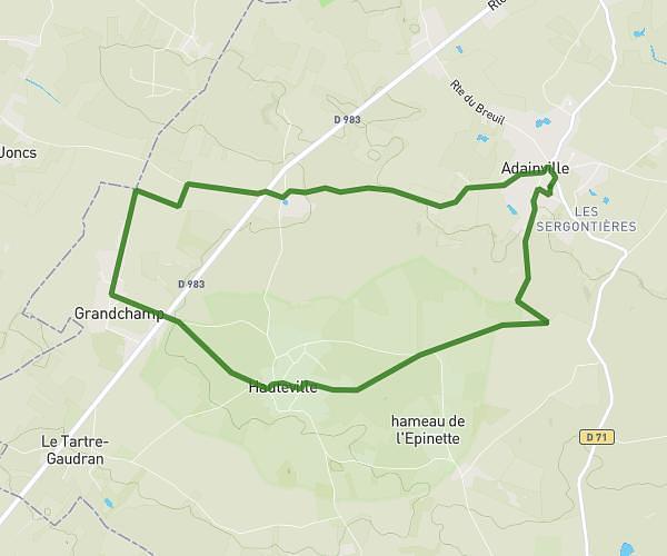
This running route covers 4.418mi starting from La Queue-les-Yvelines, Yvelines. The run is a loop trail and returns to the trailhead. This run is rated as easy, expect about 34m26s to complete it. The route has an elevation gain of 302ft and an elevation loss of 302ft.
N12 / Garancières / École
Route details
7.7mph
Speed
394 kcal
Calories burned
Loop trail
Route type
400ft
Min altitude
627ft
Max altitude
Route profile
302ft
Elevation gain
302ft
Elevation loss
400ft
Min altitude
627ft
Max altitude
How to get there
Trailhead: Rue Des Tilleuls, 78940 La Queue-les-Yvelines
GPS coordinates of the trailhead: 48.80571, 1.76033 / 48°48'20'' N, 1°45'37'' E