Albens le dimanche

Route details

4.88mph
Speed
743 kcal
Calories burned
Loop
Route type
1171ft
Min altitude
1512ft
Max altitude

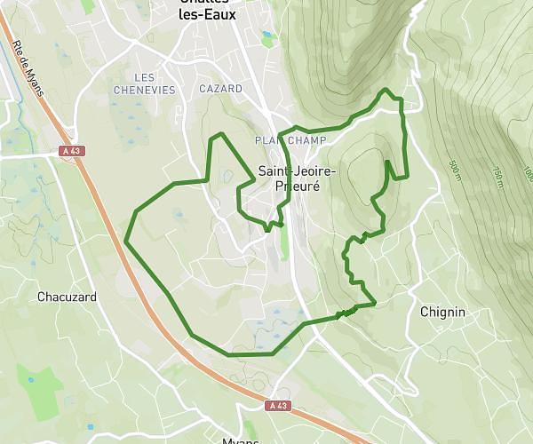
This running route covers 5.283mi starting from Entrelacs, Savoie. The run is a loop and returns to the starting point. This run is rated as intermediate, expect about 1h5m to complete it. The route has an elevation gain of 486ft and an elevation loss of 486ft.

Description of the route by the creator

Winter freshness

(Description automatically translated)

Route profile

486ft
Elevation gain
486ft
Elevation loss
1171ft
Min altitude
1512ft
Max altitude

How to get there

Route starting point: 72 Rue Du Fontanil, 73410 Entrelacs, France

GPS coordinates of the starting point: 45.78897, 5.94572 / 45°47'20'' N, 5°56'44'' E