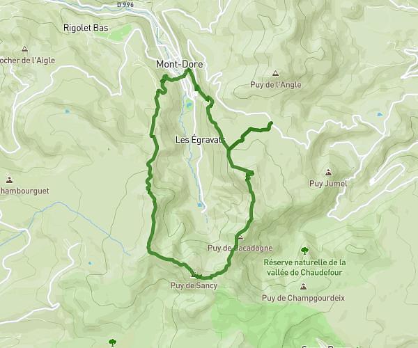
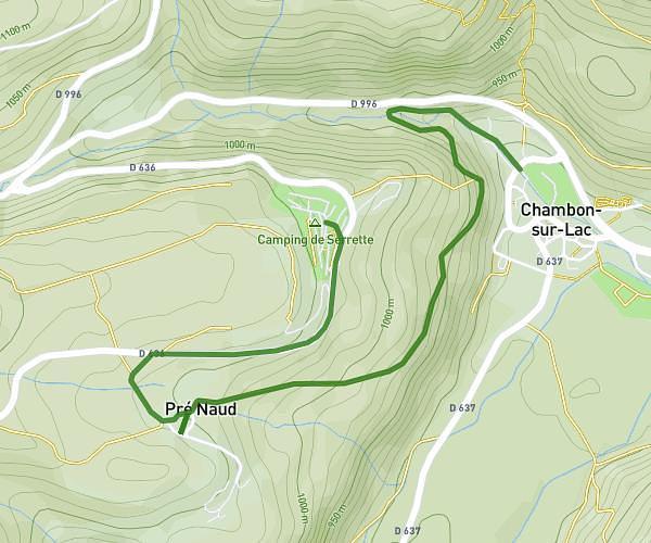
This hiking trail covers 8.76mi starting from Mont-Dore, Puy-de-Dôme. The hike does not return to the trailhead and ends near 31 Route De Chambon Des Neiges, 63790 Chambon-sur-Lac, France. This hike is rated as strenuous, plan for about 6h to complete it. The route has an elevation gain of 3146ft and an elevation loss of 2743ft.
Mont-Dore /500 diables
Route details
1.46mph
Speed
2806 kcal
Calories burned
12.7%
Avg grade
Point to point
Route type
3369ft
Min altitude
6102ft
Max altitude
Steep climb
Route profile
3146ft
Elevation gain
2743ft
Elevation loss
3369ft
Min altitude
6102ft
Max altitude
How to get there
Trailhead: 3 Place Des Moullières, 63240 Mont-Dore, France
GPS coordinates of the trailhead: 45.57568, 2.80753 / 45°34'32'' N, 2°48'27'' E