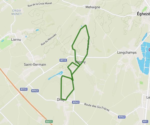
This running route covers 7.914mi starting from Les Bons Villers, Hainaut. The run is a loop trail and returns to the trailhead. This run is rated as hard, expect about 1h16m to complete it. The route has an elevation gain of 322ft and an elevation loss of 325ft.
Jogging Villers Sart Frasnes
Route details
6.24mph
Speed
869 kcal
Calories burned
Loop trail
Route type
423ft
Min altitude
525ft
Max altitude
Route profile
322ft
Elevation gain
325ft
Elevation loss
423ft
Min altitude
525ft
Max altitude
How to get there
Trailhead: Rue Du Warchais 41a, 6210 Les Bons Villers, Hainaut, Belgium
GPS coordinates of the trailhead: 50.53101, 4.48282 / 50°31'51'' N, 4°28'58'' E