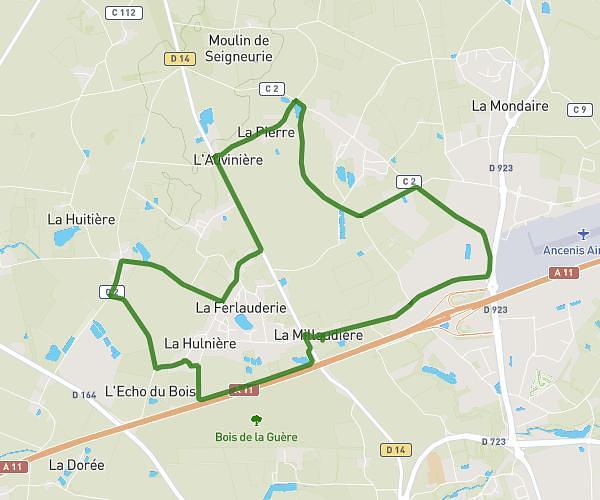
Explore this hiking route of 4.92km starting from Mésanger, Loire-Atlantique. The hike does not return to the starting point and ends near Boulevard De La Prairie, 44150 Ancenis-Saint-Géréon. This hike has no defined difficulty level, plan for about 59m1s to complete it. The route has a positive elevation gain of 32m and a negative elevation loss of 32m.
Millaudière-Espace 23
Route details
Route profile
32m
Elevation +
32m
Elevation -
15m
Min altitude
29m
Max altitude
How to get there
Route starting point: L’Océane, 44522 Mésanger
GPS coordinates of the starting point: 47.39885, -1.20962 / 47°23'55'' N, 1°12'34'' W
Calculate the time to reach the starting point from your location or an address