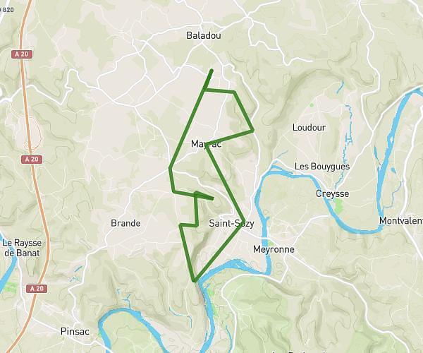
This hiking trail covers 4.341mi starting from Rocamadour, Lot. The hike is a loop trail and returns to the trailhead. This hike is rated as moderate, plan for about 1h39m to complete it. The route has an elevation gain of 781ft and an elevation loss of 781ft.
Gouffres et L'Ouysse Rocamadour
Route details
2.63mph
Speed
733 kcal
Calories burned
6.8%
Avg grade
Loop trail
Route type
354ft
Min altitude
512ft
Max altitude
Route profile
781ft
Elevation gain
781ft
Elevation loss
354ft
Min altitude
512ft
Max altitude
How to get there
Trailhead: 1511 Chemin De Cabouy, 46500 Rocamadour, France
GPS coordinates of the trailhead: 44.790692, 1.584186 / 44°47'26'' N, 1°35'3'' E