MapPlanner
4.762mi
Distance
45m
Duration
9:27/mi
Pace
Easy
Level

Franck

Route details

6.35mph
Speed
515 kcal
Calories burned
Loop trail
Route type
82ft
Min altitude
85ft
Max altitude

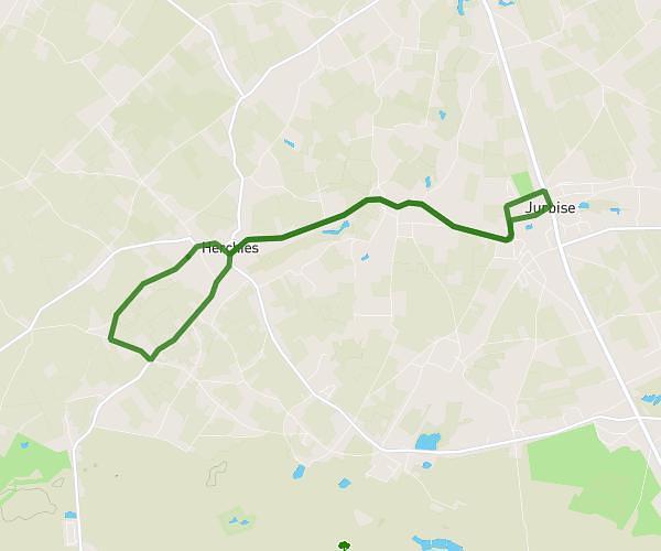
This running route covers 4.762mi starting from Mons, Hainaut. The run is a loop trail and returns to the trailhead. This run is rated as easy, expect about 45m to complete it. The route has an elevation gain of 7ft and an elevation loss of 3ft.

Route profile

7ft
Elevation gain
3ft
Elevation loss
82ft
Min altitude
85ft
Max altitude

How to get there

Trailhead: Quai Des Otages, 7000 Mons

GPS coordinates of the trailhead: 50.4539, 3.9251 / 50°27'14'' N, 3°55'30'' E

Caution: May Cross Private Property

This route may pass through or near private property. Always respect posted signs, obtain permission where required, and follow local trespassing laws. MapPlanner does not guarantee public access along any route.

Safety Notice

Trail and road conditions may change without notice due to weather, construction, or other factors. Always verify current conditions before heading out. You are responsible for your own safety — follow local signage, obey traffic laws, and use your best judgment on the trail.