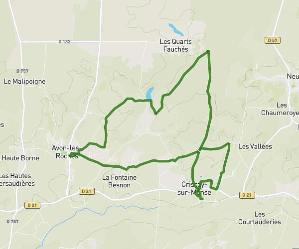
This hiking trail covers 4.045mi starting from Nouâtre, Indre-et-Loire. The hike does not return to the trailhead and ends near Marnaize, 37800 Pouzay. This hike is rated as easy, plan for about 1h7m to complete it. The route has an elevation gain of 105ft and an elevation loss of 115ft.
Journée cohésion - 11ème GMEA - 03/06/2025
Route details
3.62mph
Speed
473 kcal
Calories burned
1.0%
Avg grade
Point to point
Route type
118ft
Min altitude
148ft
Max altitude
Route profile
105ft
Elevation gain
115ft
Elevation loss
118ft
Min altitude
148ft
Max altitude
How to get there
Trailhead: Rue Guillaume, 37800 Nouâtre
GPS coordinates of the trailhead: 47.05492, 0.55612 / 47°3'17'' N, 0°33'22'' E