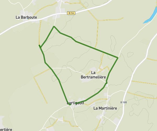
This running route covers 3.963mi starting from Melle, Deux-Sèvres. The run does not return to the trailhead and ends near Rue De La Mairie, 79500 Melle, France. This run is rated as easy, expect about 38m16s to complete it. The route has an elevation gain of 98ft and an elevation loss of 20ft.
Niveau 1 secteur Mazières et Paizay
Route details
6.21mph
Speed
438 kcal
Calories burned
Point to point
Route type
259ft
Min altitude
354ft
Max altitude
Route profile
98ft
Elevation gain
20ft
Elevation loss
259ft
Min altitude
354ft
Max altitude
How to get there
Trailhead: 43 Route De Saint-Jean-D'angely, 79500 Melle, France
GPS coordinates of the trailhead: 46.183157, -0.184905 / 46°10'59'' N, 0°11'5'' W