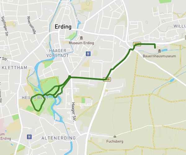
This running route covers 3.655mi starting from Erding, Bavaria. The run is a loop trail and returns to the trailhead. This run is rated as easy, expect about 39m to complete it. The route has an elevation gain of 20ft and an elevation loss of 26ft.
Weiherrunde Franze
Route details
5.62mph
Speed
446 kcal
Calories burned
Loop trail
Route type
1480ft
Min altitude
1506ft
Max altitude
Route profile
20ft
Elevation gain
26ft
Elevation loss
1480ft
Min altitude
1506ft
Max altitude
How to get there
Trailhead: Am Stadion 14, 85435 Erding, Germany
GPS coordinates of the trailhead: 48.313706, 11.914021 / 48°18'49'' N, 11°54'50'' E