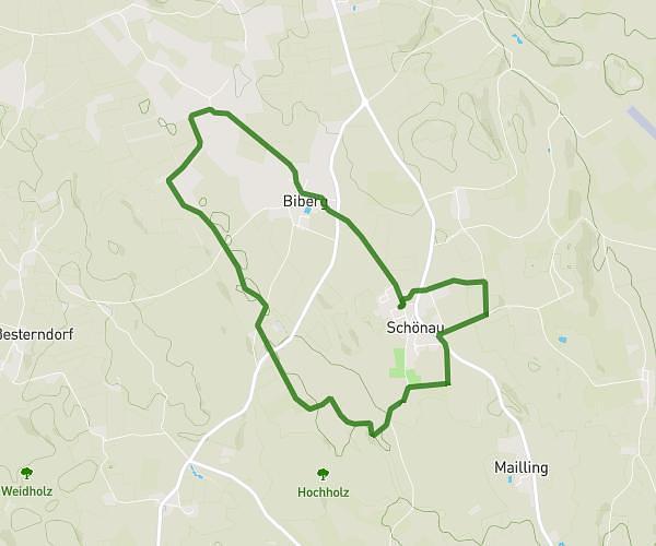
This running route covers 11.699mi starting from Ebersberg, Bavaria. The run is a loop trail and returns to the trailhead. This run is rated as strenuous, expect about 2h33s to complete it. The route has an elevation gain of 623ft and an elevation loss of 620ft.
Nikolaus HM
Route details
5.82mph
Speed
1378 kcal
Calories burned
Loop trail
Route type
1690ft
Min altitude
1929ft
Max altitude
Route profile
623ft
Elevation gain
620ft
Elevation loss
1690ft
Min altitude
1929ft
Max altitude
How to get there
Trailhead: Manfred-Bergmeister-Weg 1, 85560 Ebersberg, Germany
GPS coordinates of the trailhead: 48.093381, 11.959591 / 48°5'36'' N, 11°57'34'' E