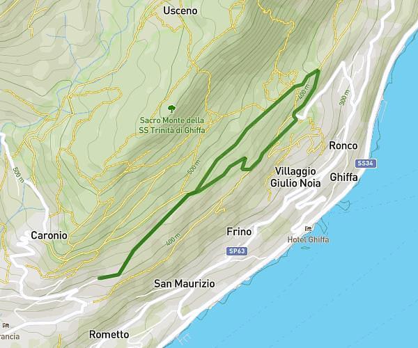
This running route covers 3.923mi starting from Ghiffa, Verbano-Cusio-Ossola. The run is a loop trail and returns to the trailhead. This run is rated as easy, expect about 1h to complete it. The route has an elevation gain of 1112ft and an elevation loss of 1106ft.
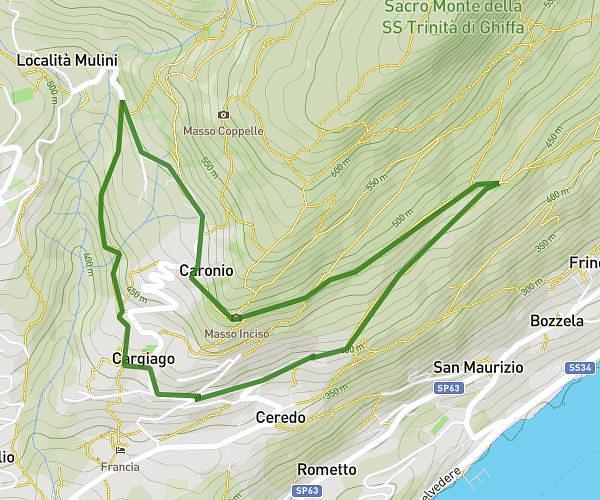
Ceredo-Monte Cargiago-Ceredo
Route details
3.92mph
Speed
686 kcal
Calories burned
Loop trail
Route type
1132ft
Min altitude
1795ft
Max altitude
Route profile
1112ft
Elevation gain
1106ft
Elevation loss
1132ft
Min altitude
1795ft
Max altitude
How to get there
Trailhead: Via Cesare Battisti 28, 28823 Ghiffa Verbano-Cusio-Ossola, Italy
GPS coordinates of the trailhead: 45.953174, 8.599448 / 45°57'11'' N, 8°35'58'' E