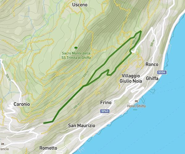
This running route covers 5.681mi starting from Angera, Varese. The run does not return to the trailhead and ends near Cascina Ronco Della Marcella 1, 21021 Angera Varese, Italy. This run is rated as moderate, expect about 1h1m to complete it. The route has an elevation gain of 1522ft and an elevation loss of 1670ft.
trail
Route details
5.59mph
Speed
697 kcal
Calories burned
Point to point
Route type
755ft
Min altitude
1342ft
Max altitude
Route profile
1522ft
Elevation gain
1670ft
Elevation loss
755ft
Min altitude
1342ft
Max altitude
How to get there
Trailhead: Strada Per S. Quirico, 21021 Angera Varese, Italy
GPS coordinates of the trailhead: 45.78615, 8.57093 / 45°47'10'' N, 8°34'15'' E