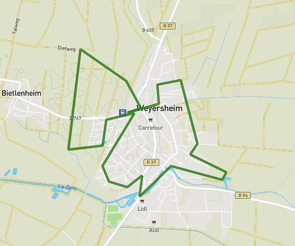
This running route covers 4.791mi starting from Herrlisheim, Bas-Rhin. The run does not return to the trailhead and ends near 33 Rue Des Veaux, 67720 Weyersheim, France. This run is rated as easy, expect about 51m to complete it. The route has an elevation gain of 13ft and an elevation loss of 7ft.
Weyersheim_herrlisheim
Route details
5.64mph
Speed
583 kcal
Calories burned
Point to point
Route type
404ft
Min altitude
417ft
Max altitude
Route profile
13ft
Elevation gain
7ft
Elevation loss
404ft
Min altitude
417ft
Max altitude
How to get there
Trailhead: Autoroute Des Cigognes, 67850 Herrlisheim, France
GPS coordinates of the trailhead: 48.72481, 7.88449 / 48°43'29'' N, 7°53'4'' E